 | Time: 0 mins.
Location: Road to Cortijo Lézar.
GPS: 519611 / 4188931 | Comments:
We start our walk by parking on the bend of the road to Cortijo Lézar, which can be found by driving down the 'Camping El Cortijillo' road and taking the first left after the first bridge across the river. After leaving the main road, take the first right and follow uphill until there is a safe place to park. |
 | Time: 10 mins.
Location: Majada de Lézar.
GPS: 519181 / 4188983 | Comments:
We arrive at the Majada de Lézar (shown in the photograph) after passing Cortijo de Lézar. Both these properties are in use, the cortijo as a goat shed, the Majada is often occupied by an elderly couple. A majada is a refuge for people and animals in inclement weather. |
 | Time: 15 mins.
Location: Track above the Majada.
GPS: 519102 / 4189006 | Comments:
Climbing up from the majada, we find that we have a good view of the Cerrada de Lézar. |
 | Time: 20 mins.
Location: Approach to the Cerrada de Lézar.
GPS: 519054 / 4189011 | Comments:
Heading west we can see the Lézar gorge ahead. |
 | Time: 35 mins.
Location: Lézar cave.
GPS: 518942 / 4189071 | Comments:
We encounter the cave, which is used by local goatherds for their flocks. |
 | Time: 50 mins.
Location: Lézar gorge.
GPS: 518937 / 4189073 | Comments:
By reversing a few metres, we can scramble down to the river bed. Depending on the time of year and whether there has been rain, we can enter the gorge. |
 | Time: 1hr 00 mins.
Location: Lézar gorge.
GPS: | Comments:
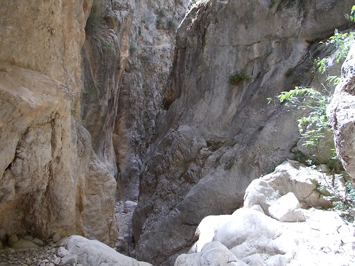
Weather permitting (be careful if there is a chance of storms), we now enter the gorge marvelling at the almost vertical walls that soar upwards to the sky. There are two places that require some climbing, but there are ropes attached for that purpose. |
 | Time: 1hr 20 mins.
Location: South down the gorge.
GPS: 518939 / 4189047 | Comments:
After having some fun exploring the gorge, we leave the entrance and go south for 100 metres where we find that the river bed is now many metres below us. From here we scramble back to the path and find our way back to the transport.
END OF WALK. |

