BEAUTIFUL CASTRIL
CASTRIL - ACTIVITIES FOR EVERYONE | 
|
 | Please note that GPS co-ordinates relate to the Spanish Grid as used by the Catastro (The Spanish official land registry) which is UTM 30 ETRS89. If you have a Garmin etrex then it should be set as follows: POSITION FRMT: UTM/UPS.TIPS FOR SURVIVAL MAP DATUM: NAD83. UNITS: METRIC. NORTH REF: TRUE. These settings should bring you to within a couple of metres of true. If in doubt, the co-ordinates of the spring (the one with a millstone on top of it) in front of Bar Zafra are 519394 / 4183249. |
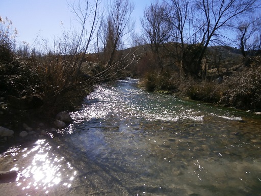 | Route: 1 Name: Rio Castril Walk Difficulty: Easy - 3.5 to 4 hours. Height variation: 900 - 750m. Start GPS co-ordinates: 519447 / 4183159 Description of walk: A pleasant easy walk to take up a morning after a flight or a difficult day. The track follows the east bank of Rio Castril to the bridge that crosses the river and then back to Castril on the west bank. There is plenty to see in the form of flora as well as old buildings. See route.... |
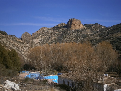 | Route: 2 Name: Around Castril Difficulty: Easy - with hills. 2 hours. Height variation: 900 - 840m. Start GPS co-ordinates: 519392 / 4182936 Description of walk: A pleasant walk with excellent views of Castril and the Peña. Some steep parts which some of us may notice. Includes a stop in the Tourist Office. See route.... |
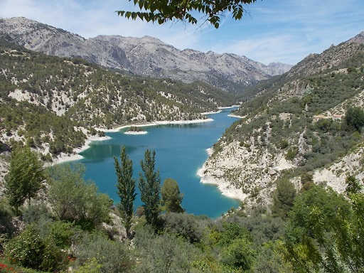 | Route: 3 Name: Puentezuelo clifftop walk Difficulty: Easy with hills. 2hr 10mins. Height variation: 927 - 1075m. Start GPS co-ordinates: 519394 / 4183249 Description of walk: A very pleasant walk with stupendous views of the whole area. Very interesting caves at El Batán. See route.... |
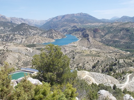 | Route: 4 Name: Fire Lookout Difficulty: Easy - moderate. Some long climbs on tracks and some fields to cross. 3hr 20mins. Height variation: 806 - 1124m Start GPS co-ordinates: 519399 / 4183240 Description of walk: An easy walk without steep slopes, except for a short scramble down through olive groves. Amazing views. See also Wikiloc data See route.... |
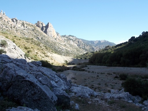 | Route: 5 Name: Source of Rio Castril Difficulty: Easy- 8.5km drive then linear walk. 50mins one way. Height variation: 1170 - 1275m Start GPS co-ordinates: 521938 / 4193740 Description of walk: Amazingly spectacular views along an easy walk to the source of the river. Some stony ground but no climbing or scrambling. One can actually walk this from Castril town, but it adds over 8km to the walk. This is the start of many longer walks. See route.... |
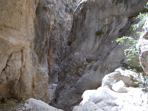 | Route: 6 Name: Cerrada de Lézar. Difficulty: Easy. 1hr 20min. Height variation: 1025 - 1100m. Start GPS co-ordinates: 519615 / 4188925 Description of walk: Spectacular walk to a gorge that cuts into sheer cliffs. Practically no scrambling and all reasonably fit people should be able to enjoy this fantastic walk. In the absence of transport, it is possible (although tortuous) to walk from Castril town essentially following route 3 and following the main road from the junction to the east of Puentezuelo. See route.... |
 | Route: 7 Name: Cerrada de Túnez. Difficulty: Easy - medium. 1hr 50mins. Height variation: 1170 - 1390m. Start GPS co-ordinates: 521938 / 4193740 Description of walk: Shortish walk with some steep slopes and some scree, but well worth the journey to be at the bottom of this enormous gorge. Track is poor in places and there is quite a bit of foliage to go through, but this shouldn't put one off. Well worthwhile. See route.... |
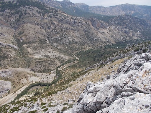 | Route: 8 Name: Barranco de La Osa. Difficulty: Medium - difficult. Some steep climbs and a fair amount of scree. 3hr 40mins. Height variation: 1170 - 1513m. Start GPS co-ordinates: 522106 / 4195683 Description of walk: Scenic walk with wonderful views of the Castril valley. Lots of stone steps and a shallow cave. See route.... |
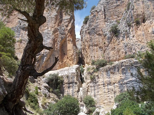 | Route: 9 Name: La Magdalena. Difficulty: A stroll in the (national) park! 40 minutes. Height variation: 1013 - 1134 metres. Start GPS co-ordinates: 521154 / 4191747 Description of walk: This is a very easy walk but with a huge reward in the form of 'La cerrada de la Magdalena'. Could be done as a warm up to Route 5 or any other of the routes that start at the end of the road. See route.... |
| Route: 11 Name: Barranco de Túnez. Difficulty: Medium. Height variation: 1,170 - 1,419. Start GPS co-ordinates: 521938 / 4193740 Description of walk: Spectacular walk up the cliffs above Río Castril and following along Río Túnez. A fair bit of scree so stout boots essential. Best done after a prolonged period without rain. See route.... | |
| Route: 12 Name: La Bolera. Difficulty: Easy. Height variation: Start GPS co-ordinates: 508261 / 4183971 Description of walk: A pleasant walk through woods and along the reservoir and the river Guadalentín. Access is by car (ideally a 4X4). After crossing the bridge over the La Bolera dam, we take the second right that has a large board and 'Senderismo' signs. Following the main road for about 5 km, we see the 'Centro de Interpretación'. Carrying on for about 1 km, we see a parking areaand an information sign. See route.... | |
| Route: 13 Name: Cerro del Buitre. Difficulty: Easy - medium. Approximately 5 hours. Height variation: 1,406 - 2,021m. Start GPS co-ordinates: 516576 / 4186896 Description of walk: A very well marked walk with wonderful views in all directions. No scrambling and no heavy exertion needed if one takes ones time. Times are approximate on this walk as there is so much to see that one tends to stop for photographs or to have a walk about. Vehicular access to the start is by 4X4 only, or add 2 hours. See route.... | |
| Route: 14 Name: Barranco de las Canalejas. Difficulty: Easy Height variation: 1,380 - 1,038m. Start GPS co-ordinates: 521164 / 4191759 Description of walk: This is a lovely, spectacular and geologically interesting walk. Most healthy people should have no trouble with this walk as it is mainly downhill. There are two ways to do this walk, the easiest is to have two vehicles. The first should be parked at Puente de Pino Hermoso (521171 / 4191479) and the second at Cortijo de las Canalejas. Alternatively, one can walk from the bridge which will make the walk much longer (2hr 30mins). Not recommended after rain or snow. See route.... | |
| Route: 15 Name: Barrancos Picón and Canalejas. Difficulty: Difficult. A lot of scrambling initially but well worth it for the views. For the more experienced walker. Height variation: 1,110 - 1,499m. Start GPS co-ordinates: 521632 / 4192747. Description of walk: Very picturesque walk with wonderful views of the Castril valley and Sierra Seca. Links up with Route 14. See route.... | |
| Route: 16 Name: Cerro del Cubo. Difficulty: Easy - A long ascent but not technically difficult. Height variation: 1,012 - 1,369m. Start GPS co-ordinates: 526777 / 4185372 Description of walk: A good walk for people looking for a gentle morning. Mostly under the cover of foliage, so good for people unused to the heat and altitude. Wonderful views from the top of the whole of the Altiplano. See route.... | |
| Route: 17 Name: Marmolance. Difficulty: Medium - somewhat challenging with some scrambling over rocks, but well worth it for the views. Height variation: 1050 - 1525m. Start GPS co-ordinates: 536186 / 4188896 Description of walk: A medium difficulty walk to the northwest of Huéscar. Excellent for viewing griffon vultures in flight and viewing La Sagra and all lands south to the Sierra de Baza and Sierra Nevada. See route.... | |
| Route: 18 Name: Las Presas de Castilléjar. Difficulty: Easy - some scrambling but nothing challenging. Can be muddy after rain. 2 hours. Height variation: 783 - 860m. Start GPS co-ordinates: 530050 / 4178009 Description of walk: A nice easy walk in the lands to the north of Castilléjar town. Very interesting geology which is more like Wyoming than Spain. See route.... | |
| Route: 19 Name: The "Badlands". Difficulty: Easy - no scrambling. Length of walk depends on the person. Up to 30km. Height variation: 740 - 897m Start GPS co-ordinates: 531462 / 4173807 Description of walk: A pleasant and geologically interesting gentle walk through the "Badlands" of Castilléjar. See route.... |
More walks are being uploaded continuously!